|
|
Post by Jenny on Nov 2, 2020 13:38:29 GMT -5
Official Solutions will be posted here
CONGRATS TO THE WINNERS TO DATE:
Jen R: LA, California
Nick S and Robert J: Bennington, Vermont
Ashley Ann and Deidra W: Eugene, Oregon
Kristopher P. and Nadine C. with BOTG by Kim S: Portersville, PA
Nadine C: Waterville, Ohio
Jen R., Nick S, Robert J : West Virginia
Kristopher P, Nadine C. , Bradley H: North Carolina
Mark W.: Virginia
Desiree H, Thedawailey, Tina J
with Nick L and wife BOTG: Washington
Jen R. with Mike C, Kristi O. BOTG: Nevada
|
|
|
|
Post by artofhiddenmessages on Nov 2, 2020 15:52:43 GMT -5
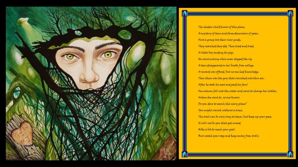 SOLUTION BENNINGTON TRIANGLE, BENNINGTON, VERMONT, AT THE MACARTHUR BRIDGE The shadow child knows of this place, = The Shadow Child is a novel written by Joseph A Citro about the Bennington Triangle en.wikipedia.org/wiki/Shadow_Child_(novel)A mystery of time and three dimensions of space. = A mystery because people disappear in this area, three sides to a triangle. First a group lost their river guide, = Middie Rivers was guiding a group of hunters and disappeared in the Long Trail Road area. He knew the area well. They searched they did. They tried and tried. = An extensive search was conducted but he was never found. A little boy tending his pigs, = Eight year old Paul Jephson accompanied his mom in their truck. He was tending his pigs. He had on a bright red coat. He went missing when mom stopped the rig. = When Paul’s mom stopped the truck and left him unattended for a bit, she later came back and he was missing. Search parties with bloodhounds could not find the boy. A teen disappeared on her break from college. = Paula Weldon, a college student on Thanksgiving break was hiking on the Long Trail and was even seen by an elderly couple, but she too disappeared and was never found. A reward was offered, but no one had knowledge. Then there was the guy that vanished into thin air, = James Tedford was on a bus coming home to Bennington when he disappeared. After he took his seat and paid his fare! = Tedford’s luggage was still in the luggage rack, and an open fare chart was on his empty seat. One woman fell into the water and went to change her clothes. = Freida Langer was camping with family in the area. She slipped in a stream and her clothes got wet. She said she would go back to the campsite to change. Where she went to, no one knows. = Freida never returned, and she wasn’t at the campsite either. Do you dare to search this scary place? You might vanish without a trace. The trail can be very long at times, but keep up your pace. = It is called the Long Trail, which is also part of the Appalachian Trail (AT, as in “at times). It will not be you that gets erased. Hike a bit to reach your goal. = There is hiking involved. But watch your step and keep away from trolls. = Doesn’t everyone know that trolls live under bridges? The proxy item is hidden by a bridge. You can read about the disappearances in the Bennington Triangle here: en.wikipedia.org/wiki/Bennington_Triangle#:~:text=Between%201945%20and%201950%2C%20five,and%20was%20never%20seen%20again. In the art, the word, “Molly” is hidden in the branches of the trees in the upper right. The proxy rock is hidden on the Molly Starks Trail, which is also Route 9. The painting is primarily green for the Green Mountains, which is where the Bennington Triangle is located. The painting is in the general shape of a triangle. People have speculated many reasons for the disappearances of these missing people, including the Bennington Monster, Big Foot, and aliens, which are depicted in the artwork. The five missing people’s initials are carved into the trees: FL, PJW, PJ, MR and JT. The MR and JT are combined to try to make the logo of the A on top of a T for the Appalachian Trail. The bark on the trees is from maple trees, common to Vermont. Found Proxy: 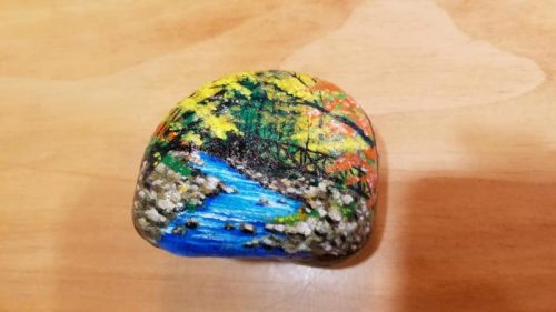 Gemstone: 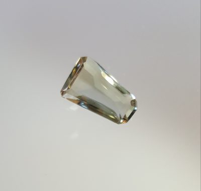 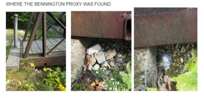 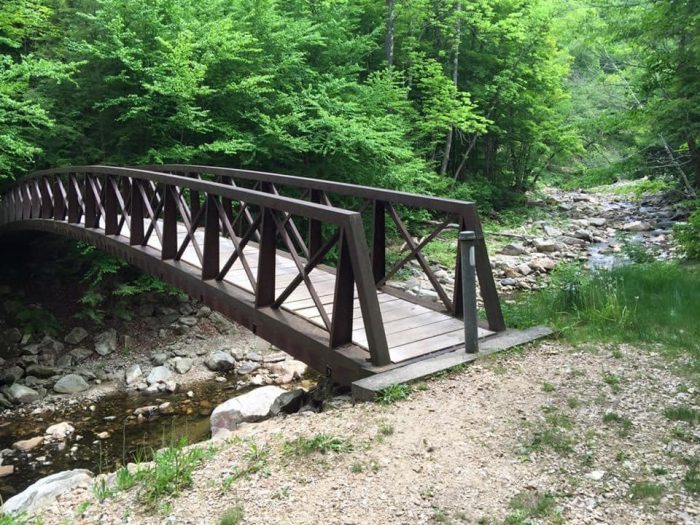 |
|
|
|
Post by artofhiddenmessages on Nov 2, 2020 16:06:56 GMT -5
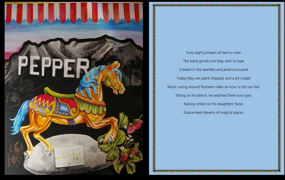 GRIFFITH PARK, LOS ANGELES, CALIFORNIA, PEPPERLAND ROCK (LOCATED BEHIND THE MERRY-GO-ROUND) Sixty-eight jumpers all tied to rope = Every horse on this merry-go-round was designed to be a jumper, and there are 68 horses on this MGR. The band grinds and they start to lope = There was a real organ (which “grinded”) and played band music. But the word “band” had triple meaning…it also meant the band, the Beatles, and referred to Sargent Pepper’s Lonely Hearts Club Band Created in the twenties and jewel encrusted = This MGR was made in the 1920 and had jewels added to it Today they are paint-chipped, and a bit rusted = The MGR is old and is showing wear Music racing around fourteen miles an hour is not too fast = This MGR went 14 miles per hour Sitting on his bench, he watched them tour past = Walt Disney used to come to this park with his two daughters and sit on a bench while they rode this MGR. There is a bench dedicated to him. The word, “tour” is used because of the Beatles song, Magical Mystery TOUR. Raising smiles on his daughters’ faces = Another reference to Walt Disney’s two daughters. Raising smiles is again from Beatles lyrics. Guaranteed dreams of magical places = The word, “guaranteed” from the same Beatles lyrics. Magical places is a reference to Disney Land.. and also Magical Mystery Tour. __________ From the Los Angeles Times: MAY 30, 1987 12 AM Beatlemaniacs can celebrate the 20th anniversary of the Fab Four’s “Sgt. Pepper’s Lonely Hearts Club Band” album at today’s noon dedication of “Pepperland” in Griffith Park. That’s right, Pepperland. Beatles fans intent on having a West Coast version of the “Strawberry Fields” garden in New York City’s Central Park have planted trees and shrubs in a four-acre plot of land next to the Griffith Park merry-go-round. Today, that plot will be christened “Pepperland.” The celebration will include the ceremonial planting of a final tree, and the unveiling of a stone monument to the Liverpudlians. The “Sgt. Pepper’s” album debuted 20 years ago Monday. _____________ ***The tangerine trees that were planted were destroyed by beetles! _____________ Here is what it reads on the Pepperland Rock Plaque: Pepperland A grove of tangerine trees and marmalade skies where dreams come true and peace abounds we thank John Lennon, Paul McCartney, George Harrison and Ringo Starr for being the human instruments of the phenomenon called The Beatles. This grove is lovingly dedicated May 30,1987 by fans of the 20th Anniversary of the release of Sgt. Pepper's Lonely Hearts Club Band. ___________ The proxy was hidden directly below the OFSGT on the plaque Found Proxy: 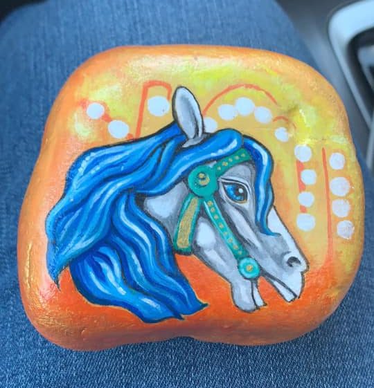 Gemstone: 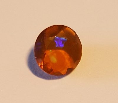 Other Images: 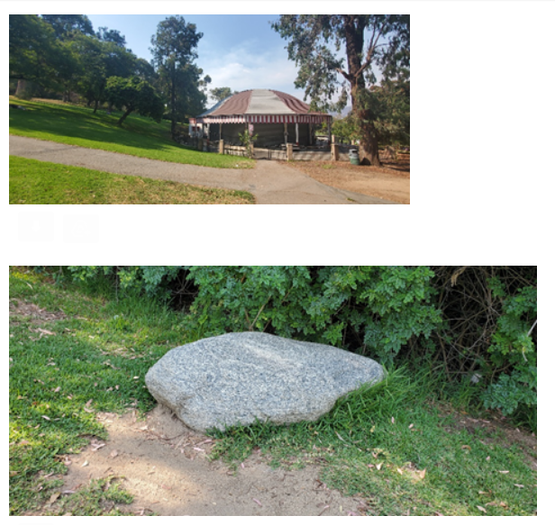 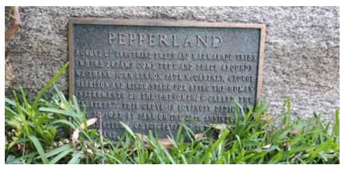 |
|
|
|
Post by artofhiddenmessages on Nov 2, 2020 16:16:09 GMT -5
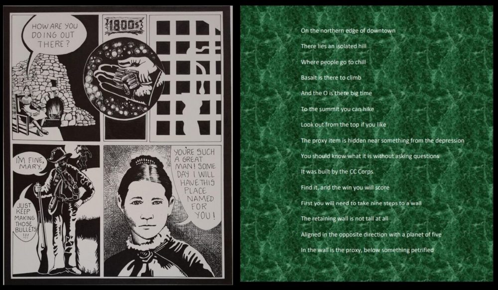 SOLUTION TO EUGENE, OREGON, SKINNER BUTTE PARK, BETWEEN THE STEPS AND THE FIREPLACE, HIDDEN IN THE RETAINING WALL COVERED WITH A PIECE OF PETRIFIED WOOD On the northern edge of downtown = Skinner Butte Park is on the northern edge of Eugene There lies an isolated hill = definition of “butte” is “isolated hill” Where people go to chill Basalt is there to climb = There are natural basaltic columns that people like to climb And the O is there big time = There is a giant letter O on the hillside for the University of Oregon To the summit you can hike = You can hike to the summit of the butte to a look-out Look out from the top if you like The proxy item is hidden near something from the depression = the fireplace was built during the depression You should know what it is without asking questions = It is the only thing in the park built by the CCC It was built by the CC Corps = The fireplace was built by the CCC (Civilian Conservation Corps) during the depression Find it, and the win you will score = find the fireplace, and this is near where the proxy item is hidden First you will need to take nine steps to a wall = There are nine steps leading from the road toward the fireplace and a wall The retaining wall is not tall at all = The wall is a small retaining wall Aligned in the opposite direction with a planet of five = If you look behind you, there is a sculpture of Jupiter In the wall is the proxy below something petrified = The proxy rock is hidden in the retaining wall under a chuck of petrified wood _______ Eugene Franklin Skinner: Founder of Eugene City Eugene Franklin Skinner was born September 13, 1809 in Essex, Essex County, New York, son of Major John Joseph Skinner. His mother died in his infancy. His father moved the family to Green County, Wisconsin when Eugene was about 14 years old. He moved back to Plattsburg, New York for a short time, but settled in Hennepin, Putnam County, Illinois where he served as county sheriff. In May, 1845, he and his wife, Mary Cook (whom he married in November 28, 1839), journeyed overland to California, hoping to regain his health. They traveled with Elijah Bristow and Wesley Shannon. The party wintered at Sutter's Fort. In 1846 Skinners came north to Oregon, stopping briefly in Polk County, near Dallas. That summer Skinner joined the Bristow party in exploring the valley to the south, and took up a claim downriver some miles from Elijah Bristow's claim at the foot of a low hill. Fortunately for Skinner, two Kalapuyas happened by, bringing trout from the river. "Build high up," they said, "Ya-po-ah." They pointed to the hillside. Using Chinook jargon, he asked why. "Big waters come some day," they told him. He was convinced to build his cabin on high ground because of the floods. Skinner selected a bench of land on the south side of the hill, cut his logs from the firs at the river's edge, and built a one-room claim cabin. This rude shelter had a door with skins hung across the opening. Its primary purpose was to hold the land until Skinner could bring his family there for permanent occupancy. The site of his first cabin is commemorated with a marker installed by the local chapter of the Daughters of the American Revolution on the hill known ever since as Skinner's Butte.n the spring of 1847, Eugene Skinner brought his wife Mary and their infant daughter Mary Elizabeth, born in December 2, 1846 in Clackamas County, to the tiny log cabin. The cabin expanded, and had two doors and a window looking out across the prairie and the wooded area to the south and west. For several months Mary was the only white woman in the region that would become Lane County (Bristow's wife, bringing several of their fifteen children, couldn't make the journey from the East until 1848). In the high valley, the few Indians had few disputes for the early white settlers. There came a day, however, when Chief Tom was filled with resentment at the thought of the occupants of the cabin at Ya-po-ah. The Skinners knew enough jargon to recognize the impending danger. Eugene shouldered his musket and patrolled the cabin that night, while Mary molded bullets over the fire. By sundown on the following day, Chief Tom and Eugene Skinner smoked the pipe of peace. The Skinners had lost three daughters to illness back in Illinois, but they eventually raised a family of several children born on the homestead. Here they farmed, operated a ferry service, and in 1852, with Judge D. M. Risdon laid out the town of Eugene. Mary Cook Skinner was priviledged to name the new town Eugene City after her husband. In 1853 Skinner donated a portion of his property for county buildings. Thereafter he practiced law, serving as county clerk and Eugene postmaster for several years. He was the father of five children: Lenora, the first white child born in Lane County, September 2, 1848; Phoebe, born March 29, 1850; St. John B. L., born November 7, 1851; Amelia R., born April 16, 1855. Mr. Skinner died December 15, 1864. There is an enormous ivy tree planted in front of 260 West Sixth Avenue, between Lincoln and Charnelton. Mary Cook Skinner brought four little firs from back of the butte and planted them together. Later she planted ivy, and over the years it became so thick the firs had to be cut down. The house that stands there today is the house where Eugene Skinner died. He took a cold from exposure during the big flood of 1861 while trying to save his cattle and never fully recovered. Mary remarried on February 7, 1867, and died on June 4, 1881 as Mrs. N. L. Packard. The story of Eugene Skinner can be found here: www.oregonlive.com/O/2010/09/founders_wife_suggests_unique.htmland here: www.oregonlive.com/O/2010/09/founders_wife_suggests_unique.htmland other places if you look! _________ Found Proxy: 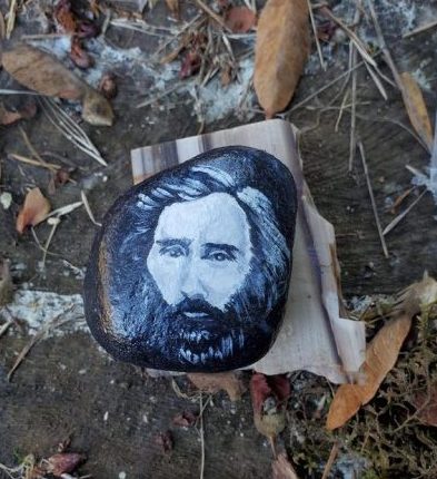 Gemstone: 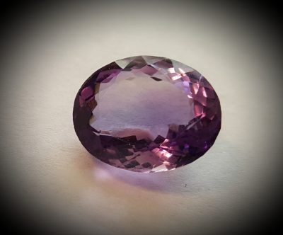 Other Images: 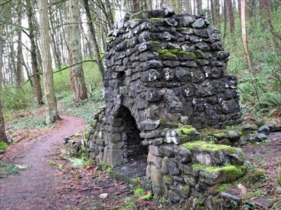 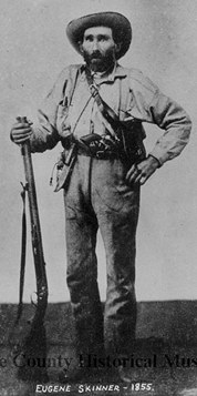 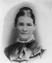 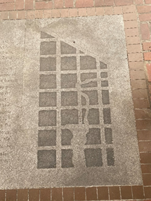 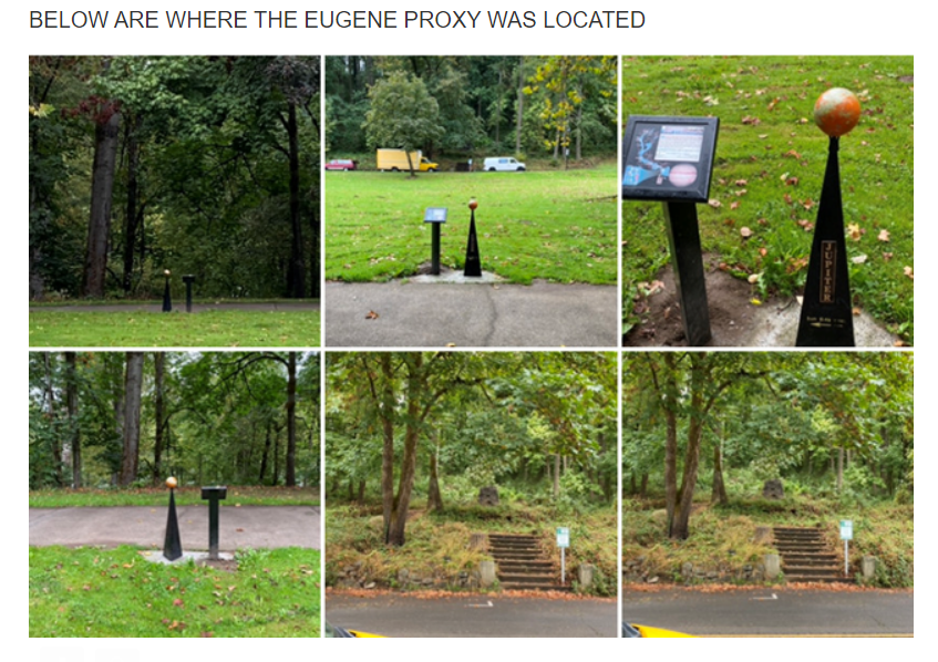 |
|
|
|
Post by artofhiddenmessages on Nov 3, 2020 12:44:01 GMT -5
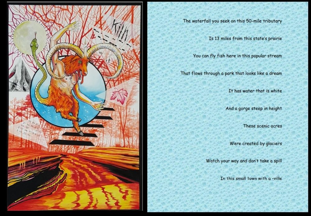 SOLUTION TO McCONNELL’S MILL STATE PARK, PORTERSVILLE, PENNSYLVANIA near Hell’s Hollow Waterfall The waterfall you seek on this 50-mile tributary = Slippery Rock Creek is a 50 mile tributary. Hells Hollows Falls is one of three waterfalls. Is 13 miles from this state’s prairie = Pennsylvania has a protected prairie at Jennings Environmental Education Center. It is 13 miles, as the crow flies, away from Hells Hollow Falls You can fly fish here in this popular stream = Many people fly fish in Slippery Rock Creek That flows through a park that looks like a dream = McConnell’s Mill State Park It has water that is white = There is white water rafting in this park And a gorge steep in height = There is a gorge These scenic acres = The park is very scenic Were created by glaciers = The gorge was created by glaciers Watch your way and don’t take a spill = There is a spillway In this small town with a -ville = The park is in Portersville, Pennsylvania |
|
|
|
Post by artofhiddenmessages on Nov 3, 2020 12:48:35 GMT -5
McCONNELL'S MILL STATE PARK IMAGE SOLUTION The image is primarily in red, for hell. The main “character” is a goat, or the devil. (Baphomet) He is prancing down steps. There are steps which lead to the waterfall. The art depicts the stream which runs along the wooded trail to the waterfall. IN THE IMAGE THE WORD “KILN” is written, as there is a kiln at the site. The Morse Code is decoded to: BEHIND YOU And the numbers are all multiples of 3 (hinted at by the triangles) decode to: 48 – 3- 9 – 15 - 57 PACES 11 (the 11 was made to look like claw scratches) 42 – 15- 3- 54 NEAR 36 – 3 – 54 – 21 – 15 LARGE 39 – 45 – 57 – 57 MOSS 9 – 45 – 66 – 15 – 54 – 15 – 12 COVERED 54 – 45 – 9 – 33 ROCK The leaf is a maple leaf, as that is what tree the proxy rock is hidden under The tree is pictured in the triangle, painted in black and white. The proxy is at the base of the tree under some rocks. So, with the kiln behind you, take 11 paces to the tree near the large moss covered rock. The numbers could also be solved by simple substitution and a frequency analysis. And if you solved the park, there are only three waterfalls there, so you could have figured out which one was near a kiln. Found Proxy: 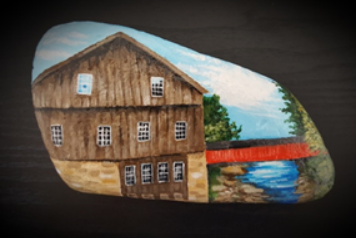 Gemstone: 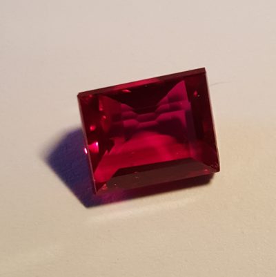 Other Images:  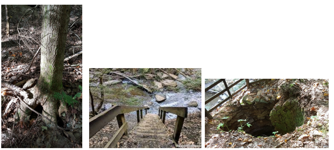 |
|
|
|
Post by artofhiddenmessages on Nov 3, 2020 17:39:53 GMT -5
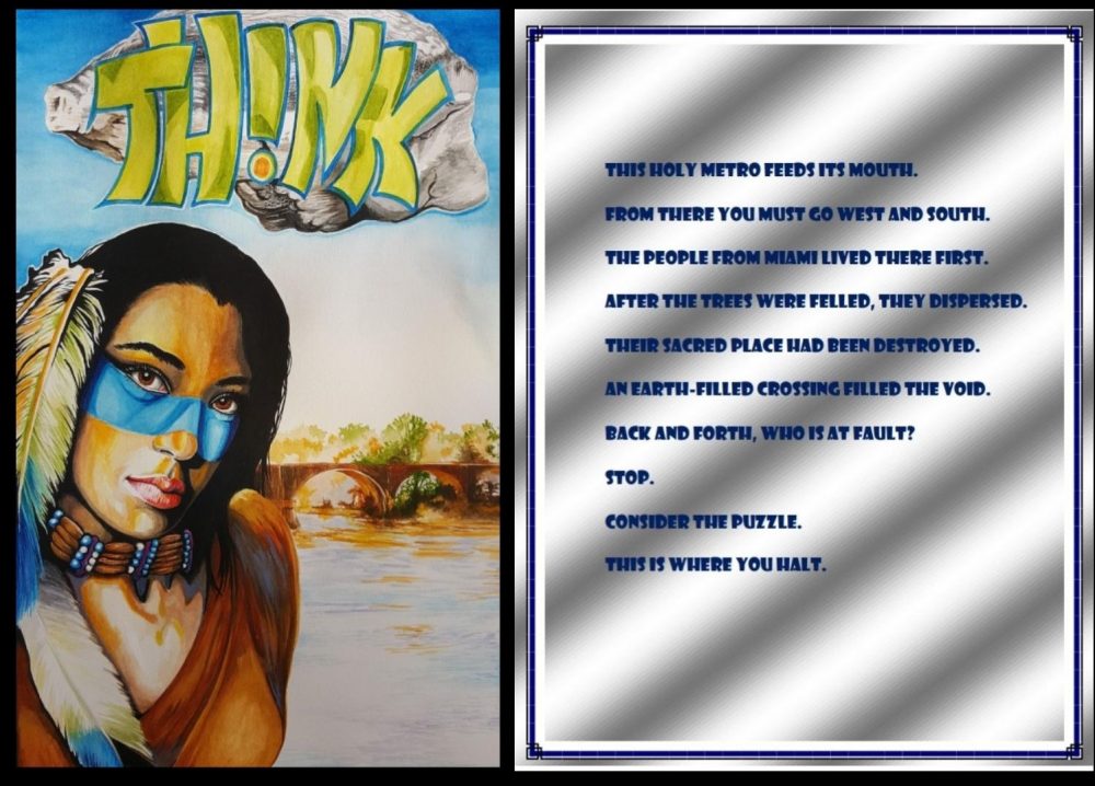 SOLUTION TO FARNSWORTH PARK, WATERVILLE, OHIO, at towpath trailhead under over hang of large rock This holy metro feeds its mouth. = Farnsworth Park is a Metro Park. The Metro is Toledo…as in “Holy Toledo”. The mouth of the Maumee River, which runs through Toledo, is Lake Erie. From there you must go west and south. = From Toledo, the metro, you go Southwest to Waterville, where Farnsworth Park is located on the Maumee River. The people from Miami lived there first. = The Indians called the Miami lived there first. They were among the Great Lakes Tribes. This is where the word, Maumee came from. After the trees were felled, they dispersed. = A reference to the Battle of Fallen Timbers Their sacred place had been destroyed. = The Indians used to meet on the outcropping, now known as the Roche de Bout. The outcropping was partially destroyed for a train crossing, and also the Interurban Bridge was built on top of the outcropping. When the outcropping was partially destroyed, there was a lot of discussion and controversy over this An earth-filled crossing filled the void. = The Interurban Bridge is a cement bridge, but it is filled with earth. Back and forth, who is at fault? = You go back and forth over a bridge. There is a 100-mile fault line here. When the water is low, it can be seen. Stop. = if you stop on one side of the bridge, you will see the “THINK” graffiti Consider the Puzzle = “THINK” is written in graffiti on the bridge. If you consider the puzzle, you are “thinking”. This is where you halt. = The proxy stone will be hidden within sight of this bridge In the art: Proxy is hidden approximately where the dot on the upside-down letter i is placed in the illustration. This rock is at the trailhead of the towpath, which has blue blazes. The woman is wearing a necklace. If you look at the blue beads, they appear in this order: 2- 13- 1-26-5. If you count the letters of the alphabet, you get, BLAZE. The main character in the illustration is an American Indian, which a lot of the poem is about The bridge in the art is painted just like the actual Interurban Bridge, which is land-filled Some additional information: Farnsworth 8505 S. River Road (US 24), Waterville Farnsworth, in Waterville, is a narrow park along the Maumee River overlooking Missionary, Butler and Indian islands, which are owned by the Ohio Division of Wildlife. The park is at one end of the Towpath Trail and has a boat launch and fishing access. The Interurban Bridge, which crosses the river at Farnsworth, is partially built atop Roche de Bout, a large, protruding rock in the river that served as an early landmark for native people, European explorers and armies. The abandoned span, once the world’s largest earth-filled, concrete reinforced bridge, was part of a commuter railway system. The Bowling Green Fault, a geological feature unique to the Great Lakes region, passes through Farnsworth. The 100-mile-long fault, which runs from south of Findlay into southern Michigan, is exposed at the Maumee River when the water is low. A fault, sometimes associated with earthquakes, is a fracture in a rock formation along which some type of movement has occurred. Some links, if interested: metroparkstoledo.com/explore-your-parks/farnsworth-metropark/en.wikipedia.org/wiki/Farnsworth_MetroparkFound Proxy: 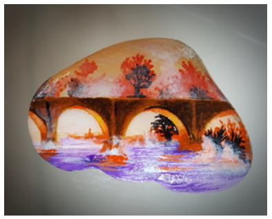 Gemstone: 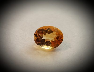 |
|
|
|
Post by artofhiddenmessages on Nov 4, 2020 13:06:46 GMT -5
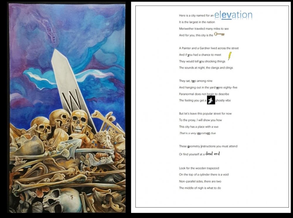 SOLUTION TO MOUNDSVILLE, WEST VIRGINIA, GRAND VUE PARK LOOKOUT, AT SHELTER 5 Here is a city named for an elevation = MOUNDsville It is the largest in the nation = The largest burial mound in the US Meriwether traveled many miles to see = Meriwether Lewis was here And for you, this city is the KEY = Moundsville is a keyword in a Vigenere Cipher for bold/underlined letters A Painter and a Gardner lived across the street = Names of 2 men electrocuted in the prison across the street And if you had a chance to meet They would tell you shocking things The sounds at night, the clangs and clings = The WV Penitentiary is said to be haunted They sat, two among nine = Painter and Gardner were 2 of 9 men who sat in “Old Sparky” and were electrocuted And hanging out in the yard were eighty-five = 85 men were executed by hanging outside in the yard Paranormal does not begin to describe = The Pen is said to be haunted, and there is also a Paranormal Museum in Moundsville The feeling you get, a ghostly vibe But let’s leave this popular street for now = popular because both the prison and the mound are there To the proxy, I will show you how This city has a place with a vue That is a very important clue = The word “vue” is spelled as it is for the park (not “view”) These geometry instructions you must attend Or find yourself at a dead end = in the park, shelter 5 is at a dead end Look for the wooden trapezoid = Look out is a wooden deck built in the shape of a trapezoid On the top of a cylinder there is a void =cylinders are the posts that hold up the deck. On top of one of the cylinders is the proxy. Non-parallel sides, there are two = A trapezoid has two non-parallel sides The middle of nigh is what to do = The non-parallel side on the left is where you need to look under for your round (cylindrical)post CIPHER: Bolded/underlined letters in poem =EVYYWWMNTGI Using the city as a key, (MOUNDSVILLE), in a Vigenere, this will decode to SHELTERFIVE The proxy was hidden at Grand Vue Park Overlook, which is right at a dead end, at shelter 5 There is a platform there made of wood. It is shaped like a trapezoid. Trapezoids have two non-parallel sides. On the left side, in the middle, one of the round posts (cylinders) that is a support post, has the proxy item wedged there up on top of the post. CLUES IN THE ART: The illustration shows a MOUND of bones, or skeletal remains. This is a clue to the name of the city. There are numbers found on the bones: The number 69 is beside a footprint and is a clue that the mound is 69 feet in height. 295 indicates the diamete, in feet, at the base. You WILL find some slight discrepancies in these numbers in looking at different websites. I used the numbers that came from the Grave Creek Mound Archaeological Complex site. The link is below. www.wvculture.org/museum/GraveCreekmod.htmlIf you climb to the top of the mound, there is a monument there. Each side of the monument has a direction, N, S, E and W. I illustrated the W for West as in West Virginia or the West Virginia State Penitentiary. Hidden in the art is a pen, for the West Virginia Penitentiary. For obvious reasons, the proxy item could not be hidden at the Grave Creek Mound or at the Penitentiary. So it was placed in an interesting park that overlooked the city. In the art, the top of the oblesk points to the section of Grand Vue Park map (in upper left of the art) where the dead end is, and where the overlook is. The Proxy: 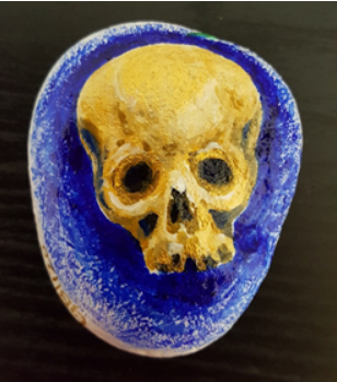 The Gemstone: 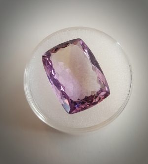 |
|
|
|
Post by artofhiddenmessages on Nov 4, 2020 13:14:19 GMT -5
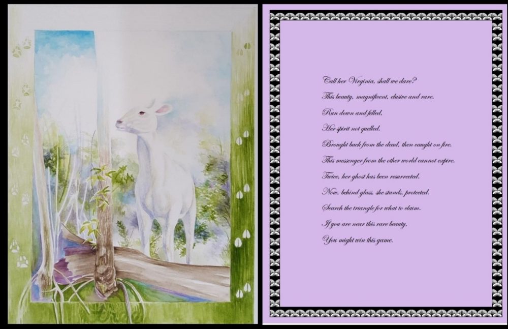 SOLUTION FOR GARNER, NORTH CAROLINA, WHITE DEER PARK, along trail, behind trees (This is right outside of Charlotte, NC) Call her Virginia, shall we dare? = There is a legend that Virginia Dare was turned into a white deer This beauty, magnificent, elusive and rare. = A white deer is said to be beautiful, elusive and rare. Run down and felled, = The white deer of Garner was hit by a car Her spirit not quelled. = Locals had the deer sent to a taxidermist Brought back from the dead, then caught on fire. = After being put on display, vandals set the deer on fire This messenger from the other world cannot expire. = White deer are known as messengers from the past (See en.wikipedia.org/wiki/Deer_in_mythology)Twice, her ghost has been resurrected. = Called a “ghost” because the deer is all white. The locals keep repairing the deer, once after being hit by a car; the second time after being put on fire Now, behind glass, she stands, protected. = The deer is now on display, but behind glass with alarms Search the triangle for what to claim. = Garner is within the Charlotte, NC “Triangle” area If you are near this rare beauty, = rare albino deer, in the Garner area, in White Deer Park You might win this game. = You just have to find the proxy to win. It can be found near this taxidermized deer. From the park’s website: www.garnernc.gov/departments/parks-recreation-and-cultural-resources/parks-facilities/parks/white-deer-park/park-informationThe park was named for an albino doe that said to have roamed the forests and fields around Lake Benson Park. From local news articles about the deer: The simply named "White Deer," a 2-year old albino deer adopted by the town of Garner as a mascot, was killed when struck by an automobile in late 2001. In November 2002, she reappeared in town -- stuffed and on exhibit at Old Garner High School. She's since moved on to a temporary stint at the North Carolina Museum of Natural Sciences, Raleigh, NC. A 96-acre park in Garner named "White Deer Park" may become permanent home of the stuffed albino in a plexiglass display -- if locals can raise the money and figure out how to prevent bucks from charging it during mating season. [11/30/2002] Garner North Carolina's "White Deer" was set on fire by unknown criminals at 4 am Friday, June 10, according to local news accounts. The stuffed albino doe was a town mascot that became even more beloved after her death from an automobile encounter in 2001. Only last week the dedication was held for a new building, called the "Little Storytelling House," where the White Deer was installed for public enjoyment at Lake Benson Park. The vandals pulled the animal out of the "Little Storytelling House," placed straw underneath, and set the White Deer ablaze. Townspeople have already raised $1,500 offered as a reward to capture the White Deer arsons. There is also talk of attempting to restore the deer hide, which was principally damaged on one side.... [Update: The White Deer has been repaired and is back on display] Update - July 15, 2005: The deer has been repaired by a taxidermist and is back in its building, which is equipped with motion detectors and perimeter lights to discourage albino deer molesters. [Thanks to Dean Jeffrey for the tip] [06/10/2005] There is a legend that claims Virginia Dare was turned into a white deer. You can read about it here: northcarolinaghosts.com/coast/virginia-dare-white-doe/And here is another version if you are interested in reading about it: boyscouttrail.com/content/story/white_deer_named_virginia_dare-3.aspAlong the bay islands, where the pale people set up their first permanent settlement, there was born a child, the one known as Virginia Dare. And the people of the islands, the Chesapeake people, called the newborn White Fawn. Around the pine-speckled islands and sea-grass peninsulas, her story was told. It said that upon the child's death, her spirit would assume the form of a frosted fawn whose face, because her race had come from across the sea, would always gaze wistfully in that direction, as if yearning for that faraway shore. The story went on to say that if ever a runner should catch the fawn after she was fully grown into a white deer and shoot her with an arrow whose head was cast of silver, this would restore her to mortal form. Now, the far banks and islands of coasts, not often met by travelers, were home to the Hatteras people, but the long salt-bitten winters presided over by hungry moons separated them from their pale friends, and in time, they lost touch with one another. One autumn day, a hunter named Little Oak came upon some ruined, abondoned log houses in the saw grass of the settlement of Roanoke. There were no pale people living there anymore; the berry brambles and rose hips had grown up between the cracks of the wind-washed logs. Slow autumn turtles lay by the cold hearthsides of cracked ashen clay. All that the hunter named Little Oak could find was an old baby's rattle, clutched by the claws of a rose thorn. Then he spied a beautiful white doe. By instinct, he drew his bow, but he would not let the arrow loose, holding it in check, the barred turkey feathers itching at his ear. Time passed and the white doe was well known amoung the hunters of Roanoke Island. Often she was seen browsing amid the brown herd of deer that lived there. But she always remained apart, turning her head to the east, sad-eyed and dreaming on the direction of the distant sea. Those who were compelled to hunt her said that their arrows, though well-aimed, fell harmless at her hooves...whereupon she would leap with the west wind, swift as milkweed down, bounding the sand hills, driving the quick curlews and iron-winged cranes up into the cold gray, slate-colored sky. Talk of the white doe flowed like a river tumbling from its source in the clefted rocks; it went various ways. Some of the people had fear of the animal, thinking her spirit was one of desolation. They said none but the spirit deer could travel the high grassy grounds od Croatan and yet the same day be seen in the cranberry bogs of East Lake. Always sad, head ever turned toward the eastern-glinting sea, always beautiful, always a little apart, the white doe danced in a dream of her own making. Then, early one autumn, the people of the islands decided what to do: They would hold a great deer hunt, and all the finest bow hunters would be invited to join in. Afterward, there would be a feast and celebration. Now the plan, they say, was to hunt the milk white doe. If any runner or hunter...and all the best were gathered there...could bring her down with an arrow, then all would know if she was flesh or spirit; and, thereafter, if she should prevail, then no one would ever go after her again. It was thus decreed, and the hunt and race was on. Some took to the high sunburned mounds above the sound; some went to the low thistle meadows of the flat ocean islands. Hunters and runners alike spread out like a peat fire across good ground, quaking ground, low ground and high; and the bird-swept prairies rang with their chants. The best bows were drawn and the straightest arrows nocked. Only one hunter, however, had an arrow with a cast-silver tip that had come from over the sea from the island known as England...a silver arrow point given, they say, by the great queen herself. This was a thing that could, it was told, reach the heart of even the most charmed lives. And it happened that the swift doe was chased from the rank grass of the shaky land; a bowstring's angry twang sent her flying on the north wind's breath. Through tangled wood and trailless bog, through morass and highland, she sped. And the myriad bowstrings made the sounds of harmless bees in the wake of her whiteness. She plunged on through the billows of the sound, reaching the sand hills on Roanoke. Here, she stood atop the ruins of the old fort, gray-logged and silvery-splintered, breathing the easternmost breeze from afar, panting, her small tongue flickering like a pink petal. Now, in the deep, wind-blown grass, Little Oak appeared, took aim at the glowing form before him, and let loose the fated bowstring that burned the air and sent the silver-headed arrow on an irretrievable mission. The beautiful sad-eyed doe leapt, heart pierced, into the air and sank desparately to the ground. Then Little Oak threw down his bow, ran to her side, lifted the head of snow, soft as a cloud, looked into the dying eyes, and saw, suddenly, the face of a pretty young woman, who, through dry, heart-spent lips, whispered her name, Virginia Dare, and died. So goes the story. And the lost Virginia Dare, what of her? Did she die in infancy? Did her child bones mingle with the dust of her legend and blossom in the wild roses of Croatan? Did she ever grow to womanhood? Did she end her life in whatever darkness that still enshrouds the lost pale colony that vanished into the deep mists? IN THE ART: The art obviously shows a white deer, for White Deer Park. Along the trail in the park are culverts, which were painted green, and footprints were added for the animals in the area. Between the culvert for the fox and the deer, is the tree pictured in the art. Below the tree, in the green border of the art, it reads, "tree" and the "T" is made into an arrow pointing to the very tree where the proxy item is hidden. It was behind that tree! The Proxy: 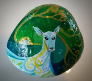 The Gemstone: 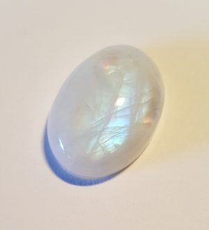 |
|
|
|
Post by DOOMer77 on Nov 4, 2020 23:19:29 GMT -5
Interesting to know that the statue of Virginia Dare that now calls the Elizabethan Gardens home, was once lost to sea and was saved from a fire. Interesting parallel to the deer’s story.
Research Triangle = Raleigh, Durham, Chapel Hill.
|
|
|
|
Post by GeneticBlend on Nov 5, 2020 8:00:52 GMT -5
I didn't know that. Thanks for sharing!
|
|
|
|
Post by artofhiddenmessages on Nov 7, 2020 10:12:32 GMT -5
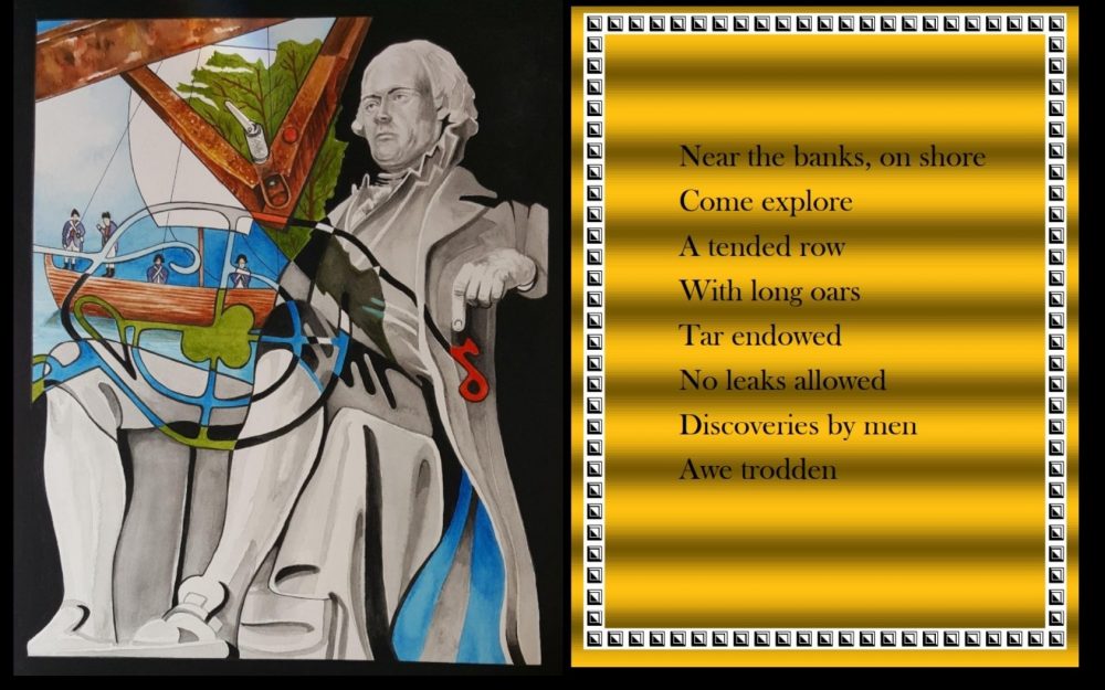 SOLUTION TO CHARLOTTESVILLE, VA, DARDEN TOWE PARK, LEWIS AND CLARK EXPLORATORY CENTER, under boat trailer Near the banks, on shore = This park is located on the banks of the Rivanna River Come explore = This is the Lewis and Clark Exploratory Center A tended row = This is an anagram of DARDEN TOWE, but there is a replica boat at this park With long oars = The boat Lewis and Clark used had long oars, and a replica is at this park Tar endowed = This is an anagram of DARDEN TOWE No leaks allowed = Tar was added to boats to prevent leaks Discoveries by men = Lewis and Clark were leaders of the Discovery Corp Awe trodden = Another anagram of DARDEN TOWE Google maps overview of the park: www.google.com/maps/place/Darden+Towe+Park/@38.0429448,-78.4523246,623m/data=!3m1!1e3!4m5!3m4!1s0x89b3885f0771c4ed:0xbe8b7cceaa752287!8m2!3d38.0422139!4d-78.451038 This map was used in the artwork, and Thomas Jefferson (who sent Lewis and Clark on their journey) is pointing to the area where the Lewis and Clark Exploratory Center is located. That area on the illustration is in RED. There is a backwards map of Virginia. The proxy item was hidden in a boat trailer at the Lewis and Clark Exploratory Center, and it too is shown backwards. The boat trailer and the map of Virginia overlap. As mentioned above, there is also RED in the illustration on the boat trailer, which marks the location of the proxy item., but at the same time, it also marks the approximate location of Charlottesville within Virginia. Also illustrated is the type of boat Lewis and Clark would have used, and the men in the boat are wearing period clothing. The Proxy: 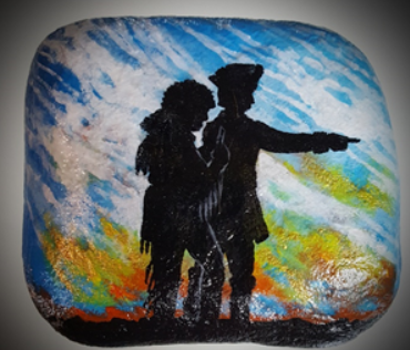 The Gemstone: 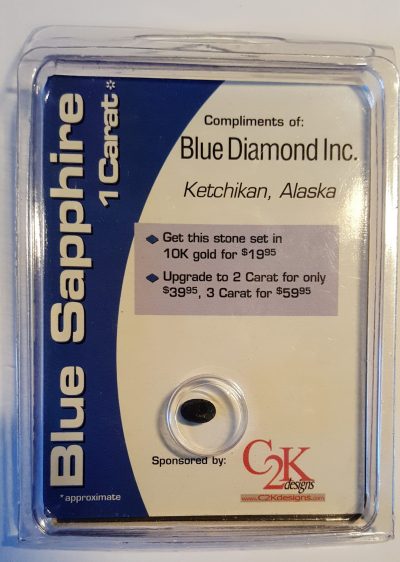 Other Images: 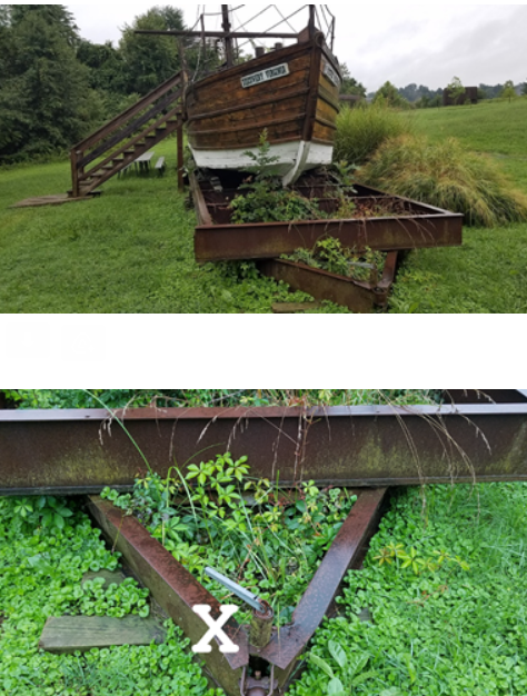 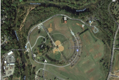 |
|
|
|
Post by artofhiddenmessages on Nov 7, 2020 17:59:42 GMT -5
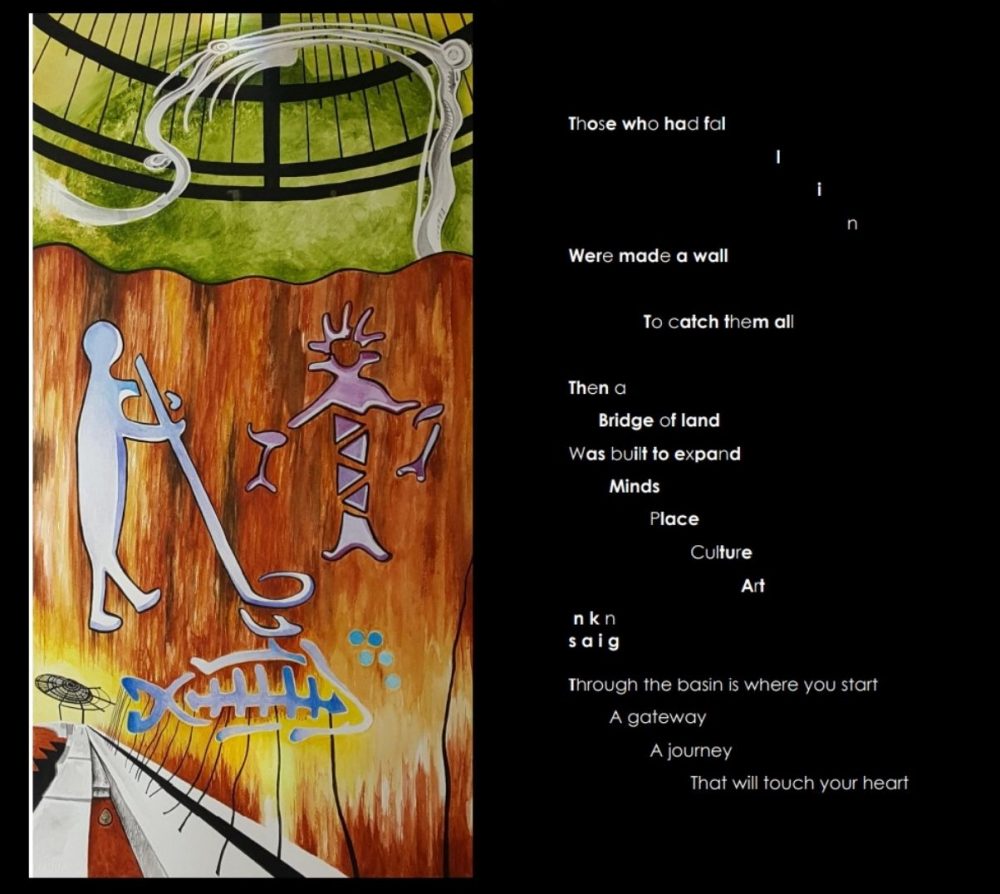 The last proxy stone was found at the VANCOUVER LAND BRIDGE IN WASHINGTON STATE. SOLUTION TO POEM: Those who had fal l i n = LIN is Maya Lin who designed the Viet Nam War Memorial in Washington DC Were made a wall = the Viet Nam War Memorial is a Wall To catch them all = all the names are captured (caught) Then a Bridge of land = LIN later designed the Vancouver Land Bridge Was built to expand = expanded our country Minds Place Culture Art n k n = SNAKING s a i g Through the basin is where you start A gateway = A gateway to the city of Vancouver A journey = like Lewis and Clark’s Journey That will touch your heart The poem is on a black background like the Viet Nam Memorial Wall Similarities are Washington DC and Washington State Encoded into the poem in Bacon Code (with the letter A in bold in B not bold) is the following: ABABA AABAA BABAA ABAAA BAAAB AAAAA ABBAA AAABB AAABA ABABA AAAAA BAAAA ABAAB BABAA AABAA BAAAA AABAA AABBB AABAA BAAAA AABAA = LEWIS AND CLARK WERE HERE The gem itself is a clue to the native people of this area, a turquoise stone. CLUES IN THE ART: Lushmiw Hidden in the illustration, lightly painted, as to hide it, is the word, “Lushmiw”. Someone who was BOTG would recognize this. As it is on the wall at the site. It is the native word for "River". The site of where the proxy was hidden was on the river side of the bridge. The white "thing" on the top is the actual land bridge as seen from above. There are metal cut-outs at the site, and those are what are painted in the art. Also, there is a black metal "roof" of sorts, which I also depicted in the image. In the lower left of the painting, is the actual spot where the proxy is hidden. Is is just under the dirt (you could wipe it away with your finger) with a rock on top of it. The Proxy: 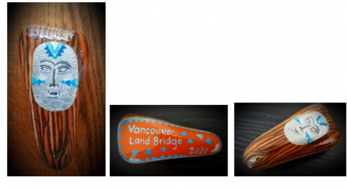 The Gemstone: 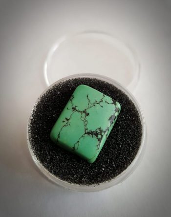 Other Images: 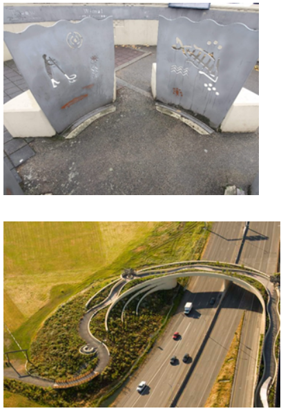 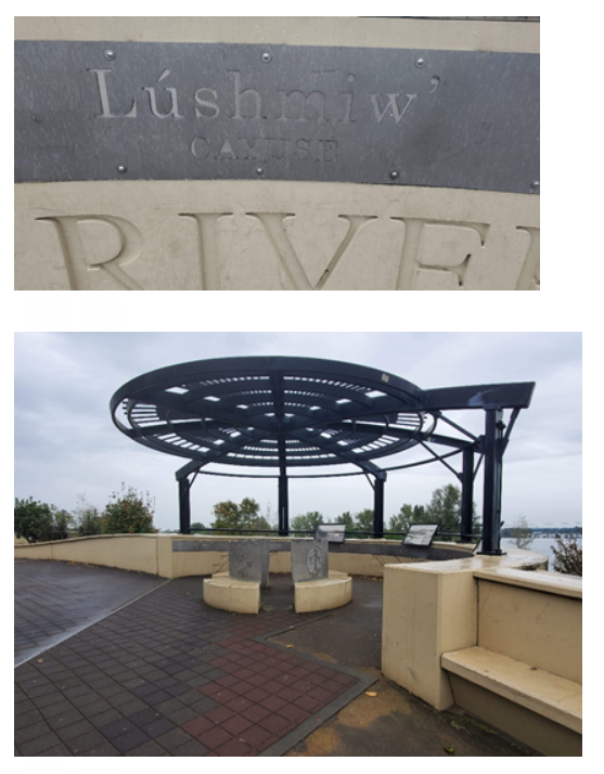 |
|
|
|
Post by artofhiddenmessages on Nov 7, 2020 18:42:54 GMT -5
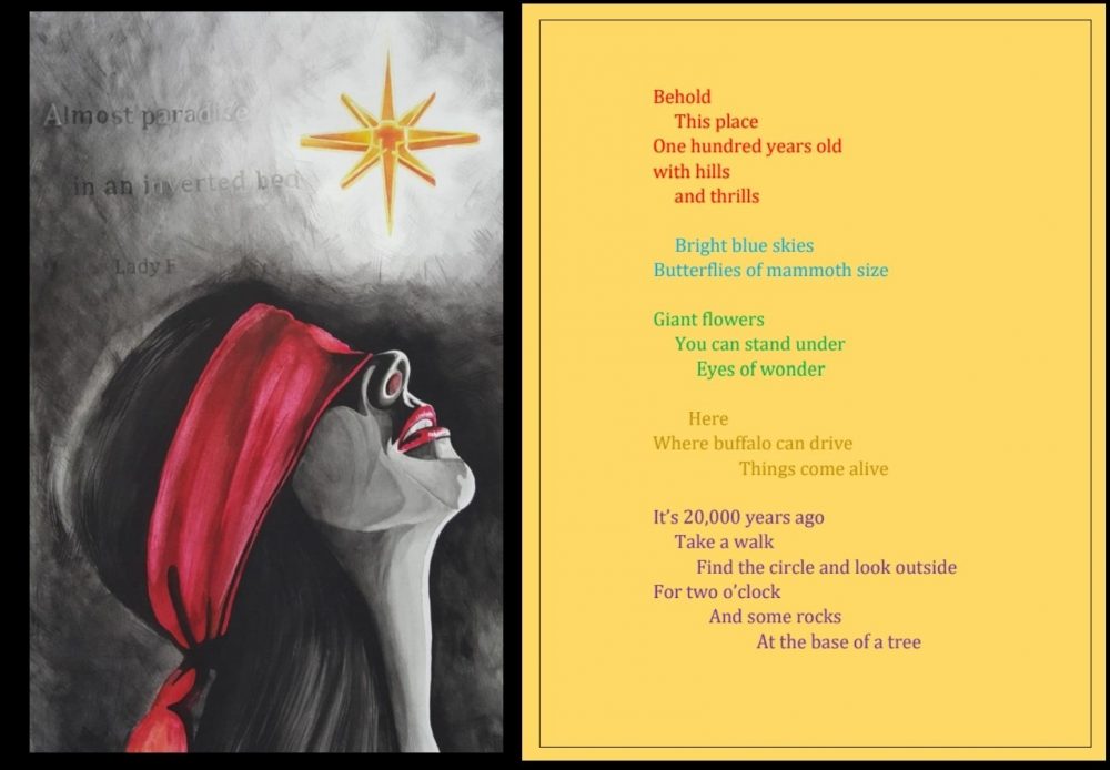 SOLUTION FOR LAS VEGAS, NEVADA, CENTENNIAL HILLS PARK, AT THE BASE OF A MESQUITE TREE IN THE ART: The shape of southern Nevada can be seen in the woman’s chin. The letters AADENV are lighter in the artwork and are an anagram for NEVADA. Lady F is Lady Fortuna, who is always depicted with a blindfold. The star is the star from the “Welcome to Las Vegas” sign. From Wikipedia” Fortuna (Latin: Fortūna, equivalent to the Greek goddess Tyche) is the goddess of fortune and the personification of luck in Roman religion who, largely thanks to the Late Antique author Boethius, remained popular through the Middle Ages until at least the Renaissance. The blindfolded depiction of her is still an important figure in many aspects of today's Italian culture, where the dichotomy fortuna / sfortuna (luck / unluck) plays a prominent role in everyday social life, also represented by the very common refrain "La [dea] fortuna è cieca" (latin Fortuna caeca est; "Luck [goddess] is blind"). From the Centennial Hills Park website: This 120-¬acre state-of-the-art regional park features a playground with ramps and features for all abilities. It is also built around an historic inverted riverbed thought to be the last remaining remnant of a large network of such channels that once covered this area. "Almost Paradise" refers to Las Vegas being close to Paradise, Nevada POEM Behold This place One hundred years old = Centennial with hills = Centennial Hills and thrills = lots of thrilling things to do there, especially for kids Bright blue skies Butterflies of mammoth size = There is a sculpture there of a Mammoth, and there are giant butterflies to provide shade Giant flowers You can stand under = There really are flowers you can stand under! Eyes of wonder = kids really look with wonder at this park Here Where buffalo can drive =The street is called Buffalo Drive Things come alive = there are sculptures of animals, giant flowers, giant mushrooms It’s 20,000 years ago = There is a walk way that has an overhead sign that says, “What if you lived 20,000 years ago?” Take a walk Find the circle and look outside For two o’clock And some rocks At the base of a tree There is one circle in the park. If you stand in the center of it, and have yourself oriented north, then look to 2 o'clock, you will see a mesquite tree. The proxy was hidden under some rocks at the base of that tree. Gemstone: 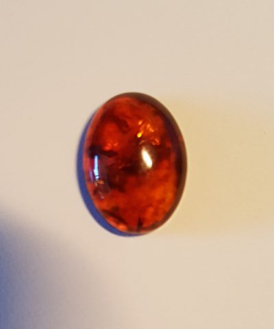 Other Images: 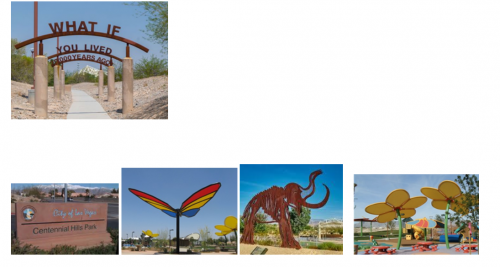 |
|
|
|
Post by desiree on Nov 7, 2020 19:52:36 GMT -5
 The last proxy stone was found at the VANCOUVER LAND BRIDGE IN WASHINGTON STATE. SOLUTION TO POEM: Those who had fal l i n = LIN is Maya Lin who designed the Viet Nam War Memorial in Washington DC Were made a wall = the Viet Nam War Memorial is a Wall To catch them all = all the names are captured (caught) Then a Bridge of land = LIN later designed the Vancouver Land Bridge Was built to expand = expanded our country Minds Place Culture Art n k n = SNAKING s a i g Through the basin is where you start A gateway = A gateway to the city of Vancouver A journey = like Lewis and Clark’s Journey That will touch your heart The poem is on a black background like the Viet Nam Memorial Wall Similarities are Washington DC and Washington State Encoded into the poem in Bacon Code (with the letter A in bold in B not bold) is the following: ABABA AABAA BABAA ABAAA BAAAB AAAAA ABBAA AAABB AAABA ABABA AAAAA BAAAA ABAAB BABAA AABAA BAAAA AABAA AABBB AABAA BAAAA AABAA = LEWIS AND CLARK WERE HERE The gem itself is a clue to the native people of this area, a turquoise stone. CLUES IN THE ART: Lushmiw Hidden in the illustration, lightly painted, as to hide it, is the word, “Lushmiw”. Someone who was BOTG would recognize this. As it is on the wall at the site. It is the native word for "River". The site of where the proxy was hidden was on the river side of the bridge. The white "thing" on the top is the actual land bridge as seen from above. There are metal cut-outs at the site, and those are what are painted in the art. Also, there is a black metal "roof" of sorts, which I also depicted in the image. In the lower left of the painting, is the actual spot where the proxy is hidden. Is is just under the dirt (you could wipe it away with your finger) with a rock on top of it. The Proxy:  The Gemstone:  Other Images:   Hey everyone, I am the “finder” of the Washington proxy today, but it was a HUGE group effort and kind of a funny story. As many saw, I was an active participant in the blog, but none were close enough for me to grab except Eugene and it was snatched fast. Anyway, I was working with another searcher, Billy, for several days and we have poured over every inch of some of these pictures and had narrowed down the petroglyphs to the southwest, which is his search area. You should see my Google history…wired black umbrella-like tourist stop…or metal UFO structures, but we could never narrow down fully the white squiggly thing or black structure, knowing it was the key. So this morning I answer a call for a northwest searcher from “thedawailey” figuring there was no way the last one was up in my area. She named the white squiggly thing, however, and I quickly became a believer after a legit Google search. She had been working with master code breaker Tina Jones, who solved the “Lewis and Clark were here” cypher and state of the poem. However, I was six hours away and started going through my contacts for a grabber. I found my boyfriend’s best friend was the closest, and a willing grabber. So Nick Lipiri to the rescue and he quickly got to the bridge and we video chatted to the find spot. He searched the area thoroughly without digging and we found a painted rock! However, “Killer Burger” in Vancouver obviously didn’t know they were going to confuse two unlucky searchers. And what are the odds really of two painted rocks in the same little dirt area?! I sent the pictures to the amazing woman in charge anyway, knowing it was wrong. I kept talking with thedawailey all day, my new east coast friend, and convinced Nick to return. He took his wife this time (and said it was the best thing they have done on a Saturday and had a blast!) and they dug the beautiful proxy up on the first try with wonderful directions from thedawailey. So this was a HUGE group effort and the prize will be split up between us all in some way. And big shout outs and thank yous to The Art of Hidden Messages for an amazing hunt! We all had a blast! Desiree & friends |
|